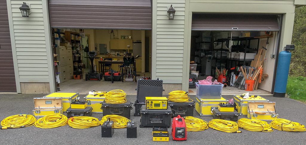
Geoscy operates a state-of-the-art Advanced Geosciences Inc. (AGI) Supersting electrical resistivity imaging (ERI) system that can be deployed at a variety of scales. The equipment includes an 8-channel Supersting R8/IP/SP WiFi Meter. This multi-channel instrument can simultaneously collect 8 different measurements from 8 different potential electrode pairs in automated fashion greatly reducing data acquisition time.
GEOSCY’s electrical resistivity imaging (ERI) system configured around the 8-channel Supersting meter in front of the Geoscy shop.
We carry 112 electrodes and sufficient passive cable to spread them over a linear distance of 560 m (1837 ft). We can deploy 2 56-channel switchboxes and 200 m of extension cable for the switchboxes. For power, we use either 12V deep-cycle batteries or two AGI 120/220V AC-DC field power converters for a Honda 1000i generator. ERI processing software is AGI’s EarthImager 2D and 3D supplemented with Golden’s Surfer. ERI data is available in real-time using the Supersting WiFi connection to AGI’s tablet software.
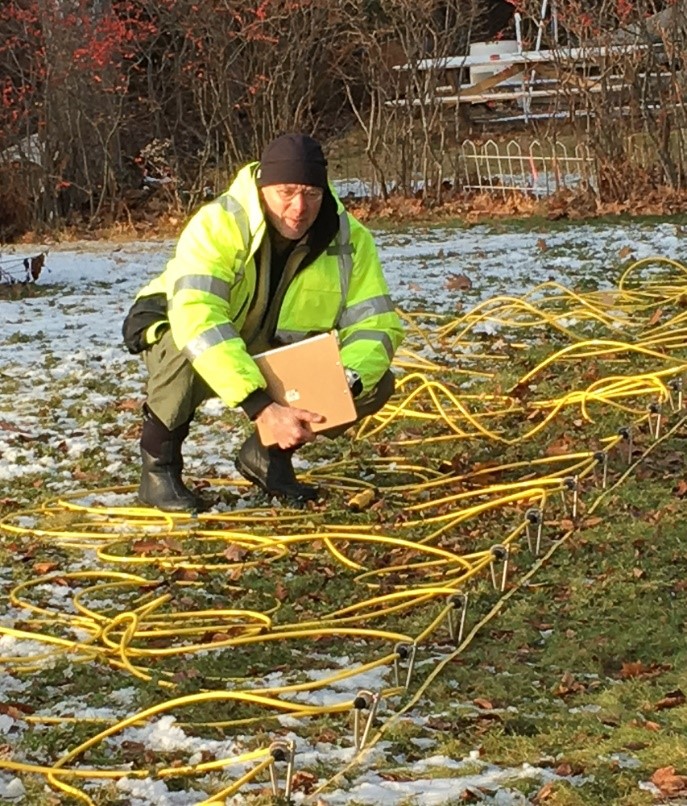
An ERI survey involves hammering steel stakes into the ground and connecting them by cable to a resistivity meter that collects subsurface resistivity information in automated fashion.
Geoscy electrodes and connecting cable during ERI survey.
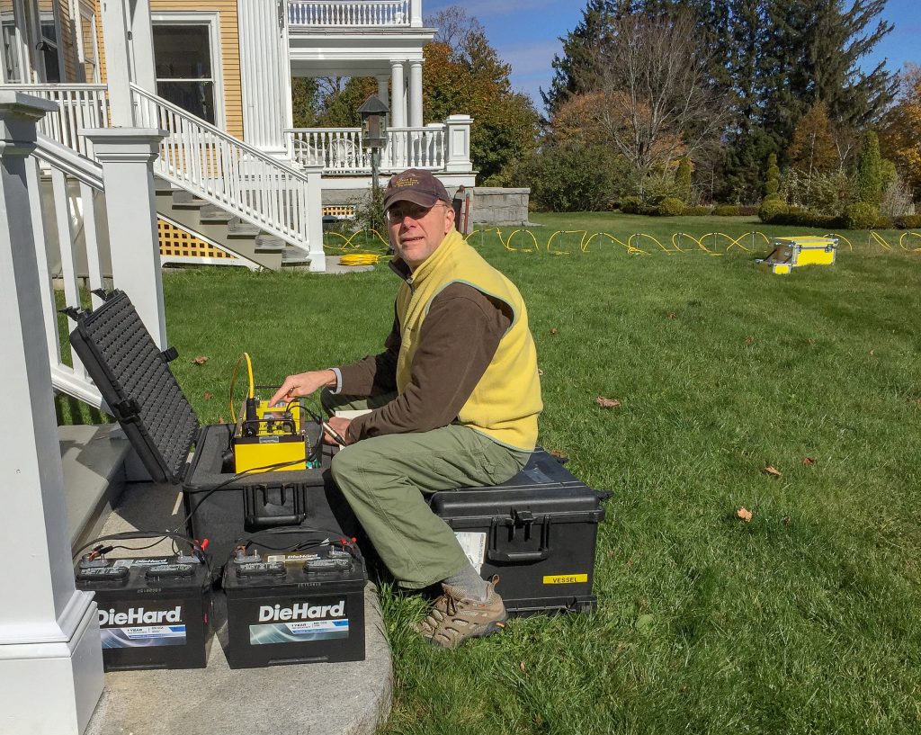
AGI 8-channel supersting control unit (yellow box in foreground) connected to 12V batteries and connected to cables in the background.
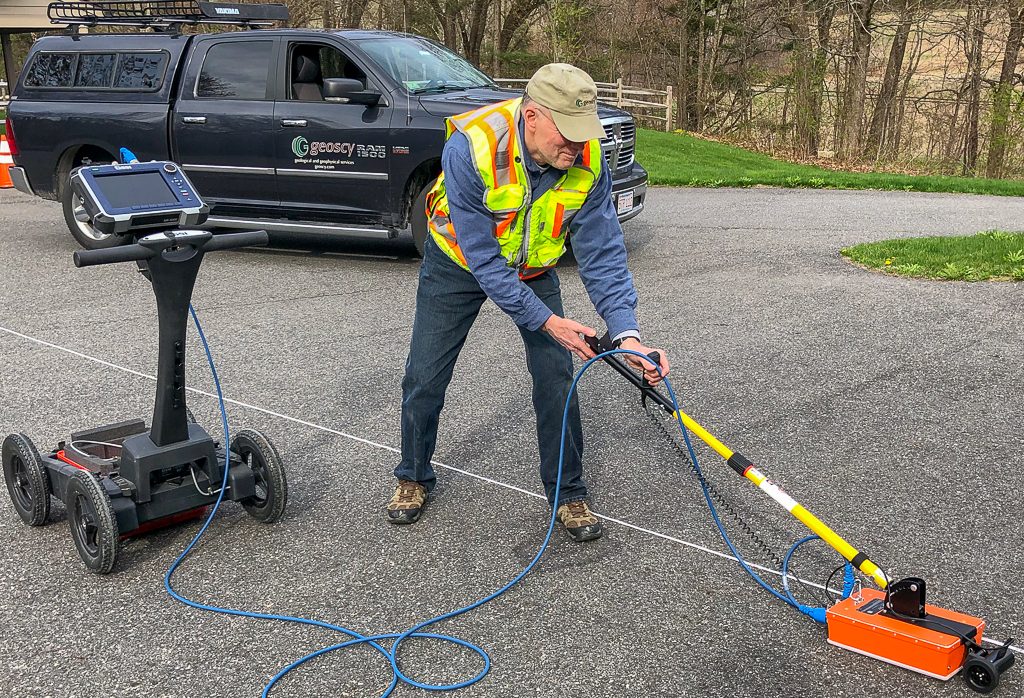
Ground-Penetrating Radar (GPR)
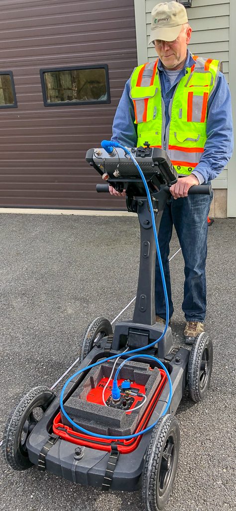
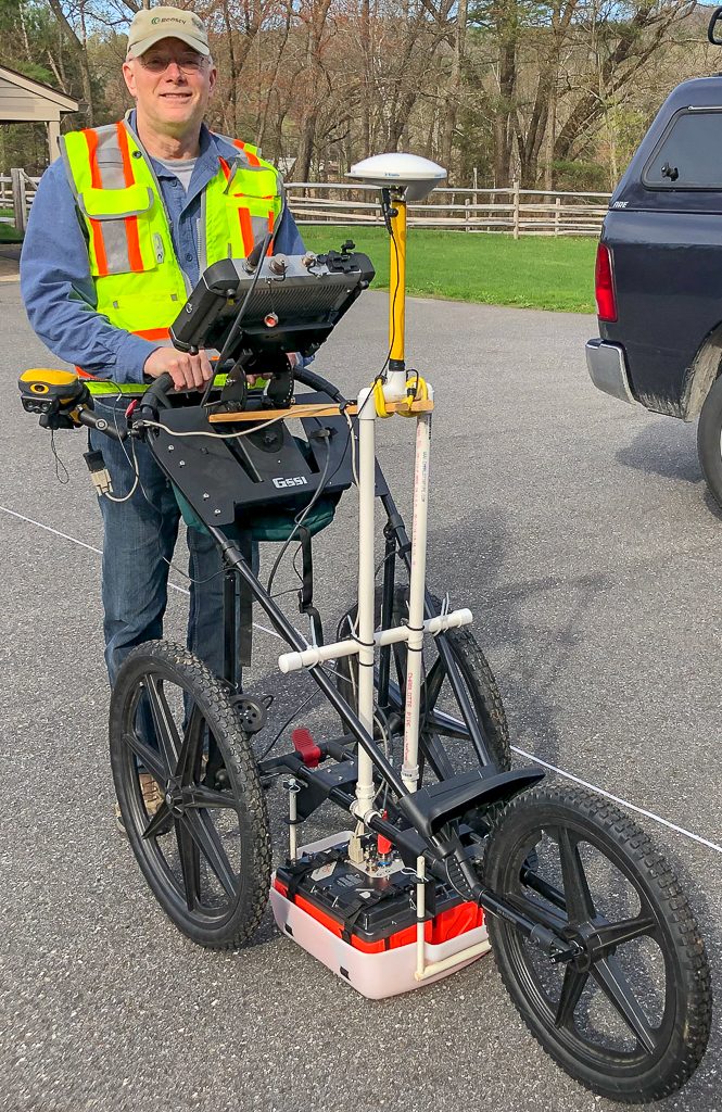
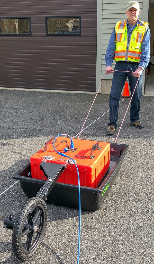
Geoscy has state-of-the-art GPR equipment to cover the full depth range needed for the building and construction industry. We use Geophysical Survey Systems Inc. (GSSI) SIR 4000 GPR controller and antennas with center frequencies at 900 MHz, 400 MHz, 350 MHz, and 200 MHz. We move the antennas equipped with odometers at walking speed in 4-wheel or 3-wheel carts, in sleds, or by dragging. We post-process GPR data using GSSI’s Radan 7.
900 MHz antenna with small (black) odometer wheel attached behind. This antenna can be moved in either of the smart-carts that use odometer wheels or in a sled. SIR 4000 controller is on the 4-wheel cart.
400 MHz antenna in bed of 4-wheel cart with odometer wheel
350HS MHz digital antenna in the bed (white tray on asphalt) of 3-wheel cart with odometer wheel. Cart is rigged with a non-metal support for GPS antenna.
200 MHz antenna in sled with odometer wheel attached behind. This antenna is normally pulled/towed by operator with the SIR 4000 controller.